 Obtaining
site model dataObtaining
site model data
Obtaining
site model dataObtaining
site model dataCommand |
Workspace: Path |
Site Model Section |
● Architect: AEC > Terrain ● Landmark: Landmark |
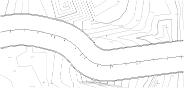
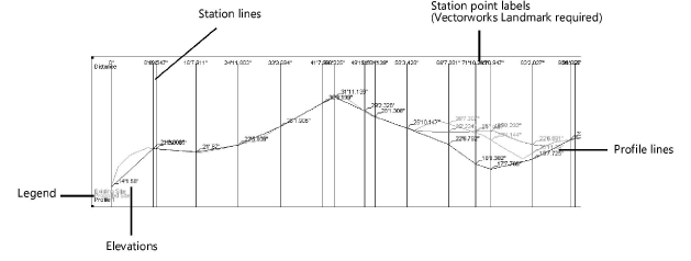
The Site Model Section command creates a profile or sectional view of the site.
To create a site model section:
1. Draw or select a 2D polygon or polyline to define the section alignment. In the Vectorworks Landmark product, if you are selecting a previously drawn polyline with station points (such as a road or Roadway (Poly) object), a station point profile can be created.
The polygon or polyline vertices must be contained within the limits of the site model.
2. With the polygon or polyline selected, select the command.
The Create Site Model Section dialog box opens. Specify the site model section parameters.
![]() Click
to show/hide the parameters.
Click
to show/hide the parameters.
The Site Model Section Formatting dialog box opens. Specify the formatting for the site model section graphic.
![]() Click
to show/hide the parameters.
Click
to show/hide the parameters.
4. Click OK to return to the Create Site Model Section dialog box.
5. Click OK to create the sectional view of the site. If the site model changes, the site model section needs to be recreated.
~~~~~~~~~~~~~~~~~~~~~~~~~