Creating a contourCreating a contour
Mode |
Tool |
Tool set |
Contour
|
Site Modifiers
|
Site Planning |
A contour is an open 3D polygon which modifies the site model, and represents a contour line at a constant elevation. The modifier can be applied to the existing or proposed site model; the site model is modified when the site model is updated. Draw a contour with the Site Modifiers tool, or draw a polyline and then select the Create Objects from Shapes command to change it to a pad object (see Creating objects from shapes).
The recommended method of creating and editing contours is by Editing site model contours.
To create a contour:
1. Click the tool and mode. Specify the pad elevation from the Tool bar if desired.
2.Draw the contour object.
The parameters can be edited from the Object Info palette.
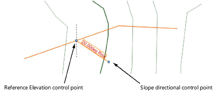
Normally, a contour site modifier does not have a slope since it indicates constant elevation. In rare cases when the modifier is sloping, specify the slope value; a slope arrow indicates the direction of the slope. The start of the slope arrow indicates the zero elevation point of the sloping contour. Select the control points of the slope arrow to move either end. Deselect Show Slope to hide the slope arrow.
![]() Click
to show/hide the parameters.
Click
to show/hide the parameters.
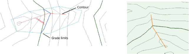
3.Normally, create grade limits around the contour.
4.To reflect the contour modification, select the site model and click Update from the Object Info palette.
~~~~~~~~~~~~~~~~~~~~~~~~~