Coordinate systems
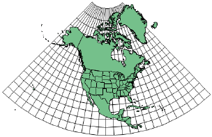
There are several options for the type of geographic coordinate system to use for georeferenced design layers. For larger maps, in particular, the proper coordinate system can be very important. A proper coordinate system has a big impact on distance measurements. A distance in the drawing and the same distance on the map will match, more or less, depending on the selected coordinate system. The closer the match to the region being worked upon, the closer and more accurate the measurements and dimensions are.
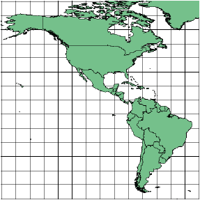
WGS 84 / Pseudo-Mercator is a global coordinate system that may be suitable for projects when a more location-specific coordinate system is not known, or not needed for collaboration purposes.
On the Document Georeferencing and the Advanced Georeferencing dialog boxes, the generic coordinate systems in the Coordinate System list include variations based upon the basic types. For example, the Plate Carrée option is based upon the Equirectangular coordinate system. Regional systems are also available, depending upon your location and your regional distributor. Enter text in the search box to filter the list.
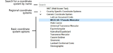
The following table describes the basic coordinate system types.
|
Coordinate system type |
Description |
|
Equirectangular |
Simplest coordinate system, good for maps of the entire world. Latitude and longitude lines are straight and equally spaced directly onto the X-Y axis. The origin represents 0°, 0°, and the scale is equal to that of the Earth’s scale of latitude and longitude at the Equator. The Lat/Lon Document Units coordinate system is Equirectangular, centered around the equator and prime meridian, and scaled such that one document unit represents one degree of latitude and longitude. The Plate Carrée coordinate system is Equirectangular, centered around the equator and prime meridian, and scaled in real-world units.
|
|
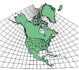
Azimuthal Equidistant |
Good for areas centered around a given point, roughly equal in height and width. Straight lines drawn from the center point represent the accurate geographic distance.
|
|
Transverse Mercator |
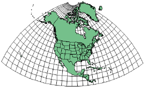
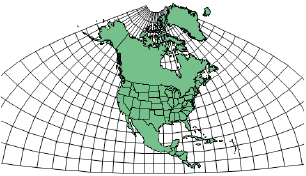
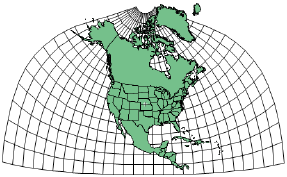
Excellent for mapping narrow (north-south) areas around a chosen longitude. Very great distortion farther east and west. Center longitude defines the chosen meridian; center latitude should be close to the area being mapped. Scale should be 1 or close to it (for example .9996). The Universal Transverse Mercator coordinate system is Transverse Mercator defined by 6° longitude zones. In the US State Plane Coordinate System (SPCS) coordinate systems, most US state zones are either Transverse Mercator or Lambert Conformal Conic, depending on the shape of the state and its zones. There are two systems, based on two different North American Datums: NAD27 (now obsolete) and NAD83 (the current standard).
|
|
Cassini-Soldner |
Good for mapping narrow (north-south) areas around the central longitude. Distorts shapes farther east and west.
|
|
Gnomonic |
Good for navigational maps and small areas around a chosen point. All straight lines represent great circles (shortest geographical distance).
|
|
Lambert Conformal Conic |
Good for mapping wide (east-west) areas between chosen parallels. Distortion increases farther from the chosen parallels. In the US State Plane Coordinate System (SPCS) coordinate systems, most US state zones are either Transverse Mercator or Lambert Conformal Conic, depending on the shape of the state and its zones. There are two systems, based on two different North American Datums: NAD27 (now obsolete) and NAD83 (the current standard).
|
|
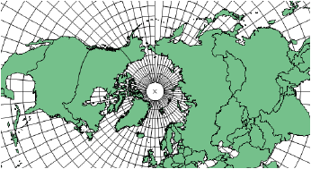
Stereographic |
Good for mapping polar areas. Parameters define the center point, which is 90 latitude for the North Pole or -90 latitude for the South Pole. Other points can be used. Scale should be 1 or very close to it (for example .9996).
|