Creating a site model snapshot
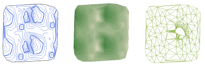
Creating a snapshot of the site model allows several display styles of the site model to be viewed at one time. Further updates to the original site model do not apply to the snapshot, unless the snapshot is unfrozen. The snapshot views cannot be edited directly. Snapshots can be from a Top/Plan or 3D view of the site model; 3D snapshots can be rendered. A snapshot legend is automatically created for 2D colored elevation or colored slope styles.
To create a site model snapshot:
Set the properties of the site model for the snapshot. The snapshot’s appearance is based on the current site model settings, and its location is based on the original source data.
From the Object Info palette of a selected site model, click Create a Snapshot.
The snapshot is created on the active layer, over the original site model.
The Object Info palette of a selected snapshot displays the parameters of the original site model, and cannot be changed for the snapshot (with the exception of the display units in Area Display Type).
By default, the site model snapshot is frozen; further updates to the site model do not affect the snapshot. Click Unfreeze to update the snapshot when you update the original site model. Freeze the snapshot again by clicking Freeze from the snapshot's Object Info palette.
Change the opacity of the snapshot (and any associated legend) by entering an Opacity value in the Object Info palette, or by adjusting the opacity with the slider. This provides a convenient way of creating a semi-transparent overlay of a snapshot for use with survey information, for example.
When the snapshot is created from a 2D view of the site model, with colored elevation or colored slope (contours or triangles) 2D Style, a legend is automatically created.
An elevation legend represents the elevation range of the site model as set by the Contour Settings in the General pane of the site model's settings.
A slope legend represents the colored slopes as specified on the Site Analysis tab of the site model's graphic properties.

Move the snapshot legend with its control point
Specify the legend properties from the Object Info palette of a selected snapshot. Adjust the text formatting from the Text menu.
Click to show/hide the parameters.Click to show/hide the parameters.
|
Parameter
|
Description |
|
Show slope legend/ Show elevation legend |
Shows or hides the legend |
|
Title Text |
Specify the legend's title, or leave the parameter blank to hide the title |
|
Legend Title Class / Legend Intervals Class |
To control appearance and visibility, select a class from the list of classes present in the drawing, or create a new class. Select <SiteModel - Snapshot Class> to place the legend in the same class as the snapshot object. |
|
Reverse order of legend |
Reverses the legend order, from min to max or vice versa |